Explore BoatView places!
Find marinas, anchorages, attractions & more
BoatView Harbor Guide - More Than Just Arrival
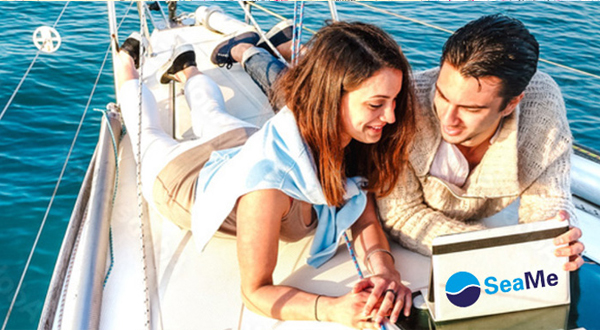
The BoatView Harbor Guide offers you fantastic features for your maritime travel planning. Start planning your journey on the BoatView website and let yourself be inspired by the top categories, daily updates from the BoatView community, and use the available current nautical charts to aid in your voyage preparations.SeaMe becomes BoatView - the popular harbor guide is not only getting a new name!
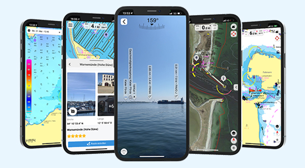
With BoatView, set course for adventure - the popular harbor guide with a new name and compelling features is now an integral part of the NV Charts App, making your journey unforgettable. The new community functions within BoatView Social also allow you to share routes with others or quickly import shared routes and start navigation directly.
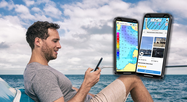
Enjoy all the features and benefits of BoatView best in the NV Charts App.
In the app, you not only discover exciting new destinations and Points of Interest (POIs), but can also easily plan, start and discover even more POIs along your route. You will be supported by the easy and intuitive use of BoatView within the app or features like Augmented Reality (AR). Here, you have the opportunity to display POIs in real-time within the app via the camera of your mobile device. Learn more here.
Featured Regions
Newest Pictures by our Community
Latest Comments & Ratings
-

 Karrebæksminde - Marina Søfrontenby Julakali, Sealady // 26.07.24Man liegt hier direkt neben einer Ferienhaussiedlung und einem Parkplatz. Keine Spielplätze erreichbar. Die Siedlung mit den Lokalen am Kanal ist sehr hübsch, für Strand ist der Hafen gegenüber empfehlenswert und allgemein ist der innere Hafen deutlich schöner gelegen, da würde ich nächstes mal reingehen.
 -
by V Kraaijeveld, Topophilia // 26.07.24Afther checking the website for free spots and prior to arriving in the harbour the harbor master unfriendly told us that we should have used our cellphones with a childish ring ring sound. The harbour had plenty of space but he told every boat it was full and send them away. Very strange encounter. Do not recommend goung here.
-
by Crew Heitmann, Anke // 26.07.24Großzügiger Hafen mit sehr guten Sanitäranlagen. Dusche ist im Liegegeld enthalten. Vom Aussichtsturm aus hat man einen tollen Rundblick über die Umgebung. Die Kinder finden einen Spielplatz und ein Museumsrettungsboot der DGzRS. Zum Strand sind es nur ein paar hundert Meter.
-
by Wolfgang , Nordje // 25.07.24Schöner ruhiger Hafen. Saubere Sanitäranlagen. Schlecht: WLAN an Bord nicht möglich, keine Kartenzahlung Wer zwei Stunden auf sein Essen am Kiosk warten will, kann sich dort niederlassen.
-
by Wolfram Rücker, Sinus2 // 25.07.24Gut geführter Anleger. Einkaufen und Bäcker in der Nähe. Gerne wieder!
-
by Henning, Wantok // 24.07.24Ein gut organisierter, sauberer Hafen i perfekter Lage zwischen Cannes und Antibes. Gute Kommunikation, Empfang mit Schlauhboot beim Einlaufen und Anlegehilfe, ordentliche Sanitäreinrichtungen. Restaurant unmittelbar an der Uferprommenade des Hafens, ein Geschäft für Bootszubehör gibt es auch. Stand direkt neben dem Hafen, was will man mehr? Unbedingt erwähnt werden muss der Automat für gekühltes Trinkwasser mit oder ohne Sprudel, siehe Bild.
-
by Henning, Wantok // 24.07.24Ein schöner, gepflegter Hafen in fußläufiger Entfernung zu Monaco. Es ist aber noch Frankreich, Gastlandflagge von Monaco ist hier falsch. Vorsicht, man landet automatisch im teuren Telefonnetz von Monaco. Bei der Ankunft wird man zum Liegeplatz begleitet und es wird beim Anlegen geholfen. Die Marina ist vergleichsweise günstig, ca. 45€ für 10m Yacht, das ist nur die Hälfte dessen, was man nebenan bezahlt. Alles bestens organisiert. Sanitäranlagen sind sehr gut, nur dass sie um 21:00 abgeschlossen werden. Im Hafen gibt es auch ein Geschäft für Yachtzubehör und ein technischer eingerichteter Laden. Auf der Westseite des Hafen ist ein schöner Strand, danach folgt ein wunderschöner Küste